

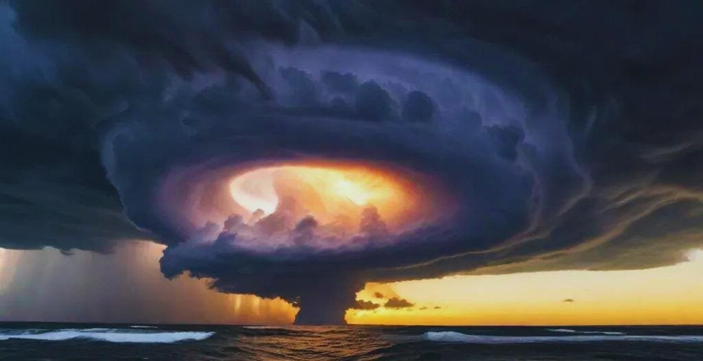
The sky turns dark. Wind blows hard. Rain pours down. A hurricane is coming! These big storms start over warm oceans and can grow very strong. They spin like tops and move across the water. When they hit land, they bring strong winds, lots of rain, and big waves.
Hurricanes are some of the strongest storms on Earth. They can knock down trees, damage homes, and change the lives of many people. Let’s look at what makes these storms so powerful and how they work.
How Hurricanes Form
Hurricanes need warm water to grow. First, the sun heats up the ocean. The warm water makes air rise up. This creates a space for more air to rush in. Then, the Earth’s spin makes all this air start turning.
At first, it’s just a small storm. But if the water stays warm and the winds don’t blow too hard in the upper air, the storm gets bigger. Soon, it spins faster and faster.
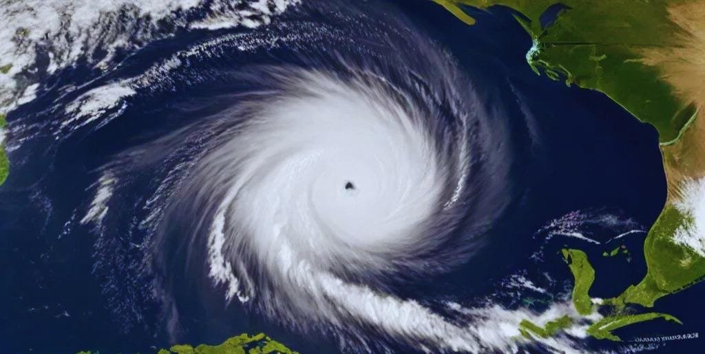
When wind speeds reach 74 miles per hour, we call it a hurricane. The center of the storm is called “the eye.” It’s a calm spot with clear skies! But don’t be fooled. Around the eye is the “eyewall” where the strongest winds blow.
Why Hurricanes Are So Strong
What makes hurricanes so powerful? Here are the main reasons:
Warm Water Fuel: Hurricanes eat up warm water like a car uses gas. The warmer the water, the stronger the storm can get. This warm water must be at least 80 degrees down to about 150 feet deep. This gives the storm a lot of energy to use.
The Spin Effect: As the storm spins, it pulls in more warm, wet air. This air adds more power to the storm. The spin also helps the storm stay together as one big system instead of breaking apart.
The Eye Structure: The eye and eyewall work together like a team. The calm eye helps the storm stay strong, while the eyewall packs the worst winds. The eye can be 20 to 40 miles wide, while the eyewall is a ring of tall clouds that makes the strongest part of the storm.
Water Vapor Power: When water vapor rises and turns into clouds, it releases heat. This heat gives the hurricane more energy to grow. Scientists call this “latent heat,” and it works like adding wood to a fire.
Size Matters: Big hurricanes have more power and last longer. They can be more than 300 miles wide! Some of the biggest storms have spanned 1,000 miles, which is as wide as the state of Texas.
Low Pressure Center: The middle of a hurricane has very low air pressure. This helps pull in more air from all sides, making the winds blow harder toward the center.
Hurricane Categories
Scientists rank hurricanes by how strong their winds blow. They use a scale from 1 to 5, called the Saffir-Simpson scale.
Category 1: Winds of 74-95 mph. These can damage roofs and knock down some trees. Mobile homes might be damaged. Power lines may come down, causing short outages.
Category 2: Winds of 96-110 mph. These can cause major roof damage and knock out power for days. Many trees will snap or be uprooted. Almost all mobile homes will suffer major damage.
Category 3: Winds of 111-129 mph. Now we call this a “major” hurricane. It can cause serious damage to homes. Many trees will snap. Power and water might be out for days or weeks. Roads will be blocked by fallen trees.
Category 4: Winds of 130-156 mph. These storms can tear off roofs and walls. Power might be out for weeks or months. Most trees will be snapped or uprooted. Most of the area will be unlivable for weeks or months.
Category 5: Winds above 157 mph. These rare monsters can flatten houses and make areas unlivable for months. Few walls will remain standing in many homes. Most areas will be without power and water for weeks or months.
The Parts of a Hurricane
A hurricane isn’t just one big blob of storm. It has different parts:
The Eye: This is the calm center. The air here moves down, not up. The sky can even be clear blue! People who have been in the eye say it’s eerily quiet after the roaring winds of the eyewall pass.
The Eyewall: This ring around the eye has the fastest winds and heaviest rain. It’s where the most damage happens. The eyewall can be 5 to 30 miles thick and can rise 9 miles high into the sky.
Rain Bands: These are the long “arms” of the storm that spiral out from the center. They bring strong wind and heavy rain too. These bands can extend hundreds of miles from the center and often spawn tornadoes.
Outer Bands: These parts can reach hundreds of miles from the eye. They can cause flooding even far from where the hurricane hits land. These outer bands often hit land hours before the eye arrives.
The Outflow Layer: At the top of the hurricane, air flows out away from the center. This helps the storm keep pulling in more air at the bottom. You can see this part in satellite pictures as the thin, wispy clouds at the top of the storm.
Hurricanes Around the World

Did you know that hurricanes have different names in different places? In the Atlantic and East Pacific, we call them hurricanes. But they’re called:
- Typhoons in the West Pacific
- Cyclones in the Indian Ocean and South Pacific
No matter what we call them, they all work the same way. They need warm ocean water to grow strong.
The word “hurricane” comes from “Hurakan,” the storm god of the Taino people who lived in the Caribbean. The word “typhoon” may come from the Chinese “tai fung,” which means “great wind.”
Some places see more of these storms than others. The western Pacific gets the most, with about 30 typhoons each year. The Atlantic usually has about 10 hurricanes each year.
How We Track Hurricanes
Long ago, hurricanes would show up with little warning. Now, we have many tools to see them coming:
Weather Satellites: These take pictures from space to show where storms are and how they’re moving. Some can take a picture every minute to watch how the storm changes.
Hurricane Hunters: Brave pilots fly special planes right into hurricanes to measure how strong they are. They drop tools called “dropsondes” into the storm that radio back data as they fall.
Computer Models: Big computers use math to guess where hurricanes will go next. They take in lots of data like wind patterns, ocean temps, and air pressure to make their best guess.
Radar: This helps us see inside the storm to learn about its rain and wind patterns. Doppler radar can even show which way the winds are blowing inside the storm.
Ocean Buoys: These floating weather stations measure water temps and wind speeds. They help us know when waters are warm enough for hurricanes to form.
Thanks to these tools, we can warn people days before a hurricane hits. This helps save lives.
The Impact on Land
When hurricanes reach land, they bring several dangers:
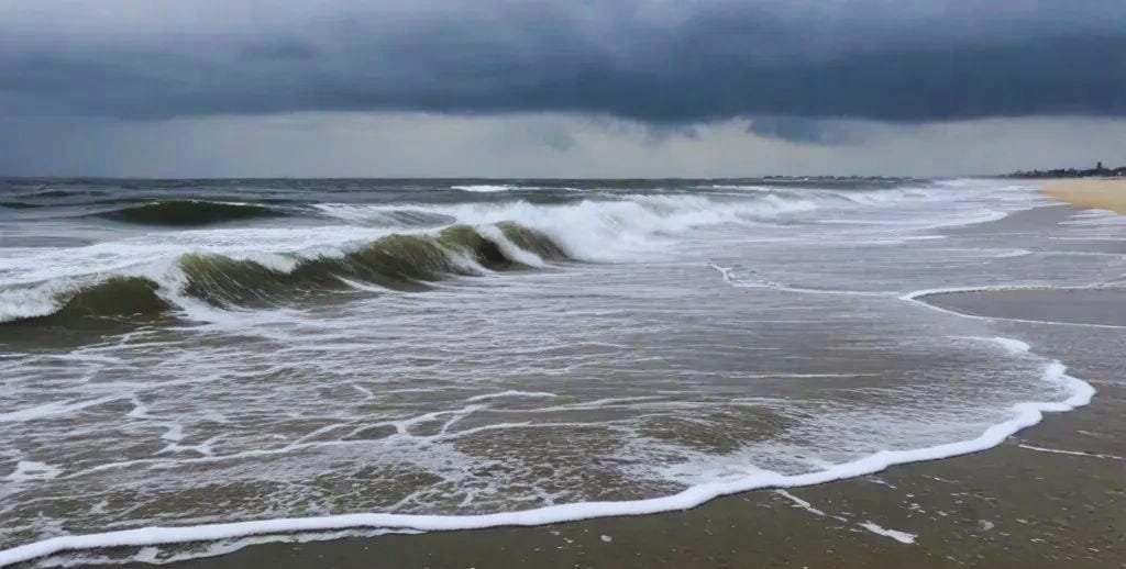
Storm Surge: This is when the ocean rises up and moves onto land. It can be 20 feet high or more! Storm surge causes most hurricane deaths. It can rush in like a fast-rising flood.
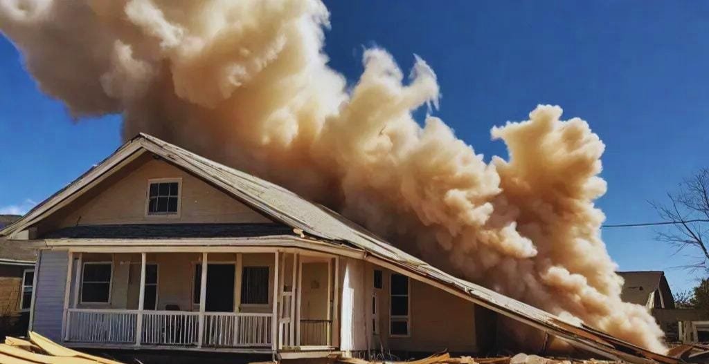
Wind Damage: The strong winds can tear off roofs, knock down walls, and throw things through the air like missiles. Trees can crash onto homes, cars, and power lines.
Flooding Rains: Hurricanes can drop 20 inches of rain or more. This causes rivers to flood and can make flash floods in places far from the coast. Hurricane Harvey dropped over 60 inches of rain in Texas in 2017.
Tornadoes: Hurricanes often spawn many small tornadoes, mainly in their right front side. These can cause extra damage in small areas.
Landslides: In hilly or mountain areas, all the rain can make the ground give way. This can bury homes and block roads, making it hard for help to arrive.
Staying Safe During a Hurricane
When a big storm comes, it’s important to be ready:
Make a Plan: Know where to go if you need to leave your home. Have a meeting spot for your family in case you get split up. Know the best roads to take to get to higher ground.
Get Supplies: Have water, food, flashlights, and batteries ready. You should have at least 3 days of water (one gallon per person per day) and food that won’t spoil. Don’t forget pet food!
Listen to Warnings: If officials say to leave, do it right away! Don’t try to “ride out” a bad storm if you’re told to go. A “watch” means a storm might come. A “warning” means it will hit soon.
Protect Your Home: Board up windows and bring loose things inside. Clean out gutters so water can flow. Fill bathtubs with water for flushing toilets if the water goes out.
Know Your Zone: Find out if you live in an area that might flood. These are often called “evacuation zones.” If you’re in one, you may need to leave when a storm comes.
After the storm passes, be careful. Don’t walk or drive through flood water. Stay away from downed power lines. Check on your neighbors if you can do so safely.
Historic Hurricanes
Some hurricanes are so strong or cause so much damage that we remember them for years:
Galveston Hurricane (1900): This storm hit Texas with little warning and killed over 8,000 people. It’s still the deadliest natural disaster in U.S. history.
Hurricane Katrina (2005): This storm flooded New Orleans when the levees broke. Over 1,800 people died, and damage cost more than $170 billion.
Hurricane Sandy (2012): This huge storm hit the Northeast U.S. and flooded parts of New York City. The subway tunnels filled with water!
Hurricane Maria (2017): This storm hit Puerto Rico and left the whole island without power for months. Some places didn’t get power back for almost a year.
Hurricane Dorian (2019): This storm sat over the Bahamas for more than a day with winds of 185 mph. It destroyed whole towns.
Each of these storms taught us new lessons about how to prepare for hurricanes and how to build safer communities.
How Climate Change Affects Hurricanes
The Earth is getting warmer. This means the oceans are warming up too. Since hurricanes feed on warm water, many scientists think hurricanes might get stronger in the future.
We might also see:
- More rain from hurricanes
- Slower-moving storms that drop more rain in one place
- Higher storm surge as sea levels rise
- Storms that grow strong more quickly
- Hurricanes forming in new places as warm waters spread
Scientists are still studying how all this works. But one thing is clear: we need to be ready for strong storms.
Some places are getting ready by building stronger homes, making better flood plans, and planting more trees to help soak up rain. Some coastal towns are even moving buildings away from the shore.
Hurricane Research
Scientists work hard to learn more about hurricanes. Here are some cool things they do:
Wind Tunnels: They use big fans to see how hurricane winds affect buildings. This helps them design stronger homes.
Computer Simulations: They make detailed models of storms on computers to test ideas about how hurricanes work.
Drone Flights: They send robotic planes into storms to get data from places too dangerous for people to go.
Ocean Robots: They drop robots into the ocean that can dive deep to measure water temps during storms.
All this research helps us understand storms better. It also helps us make better warnings and build safer towns.
Conclusion
Hurricanes are amazing but dangerous forces of nature. They start as small storms over warm oceans. Then they grow into spinning giants that can change landscapes. Their mix of wind, rain, and storm surge makes them nature’s most powerful storms.
By learning about how hurricanes work, we can better prepare for them. New tools help us track these storms and warn people in their path. Better building codes help homes stand up to the winds. And better flood plans help keep people safe.
As our climate changes, we may face stronger hurricanes in the future. This makes it even more important to understand these powerful storms and how they affect us. Communities along coasts must plan for these changes to stay safe.
The next time you hear about a hurricane, you’ll know what’s happening inside that swirling mass of clouds. From the calm eye to the fierce eyewall, hurricanes show us the raw power of our planet. And with good planning and teamwork, we can stay safe when these mighty storms come our way.
FAQ About Hurricanes
What’s the difference between a hurricane and a tornado?
Hurricanes form over warm oceans and can be hundreds of miles wide. They last for days or weeks. Tornadoes form over land, are much smaller, and usually last less than an hour. Hurricanes bring both wind and rain, while tornadoes mainly cause wind damage. Tornadoes have faster winds than hurricanes, but affect a much smaller area.
Can we stop hurricanes?
Not yet. Hurricanes are too big and powerful for us to stop. Scientists have thought about ways to weaken them, but so far, we can only track them and prepare. Some ideas people have suggested include cooling the ocean with ice, seeding clouds, or using wind machines, but none of these would work well. A hurricane releases as much energy as 10,000 nuclear bombs, so our human tools are too small to affect it much.
Why do hurricanes have names?
We name hurricanes to make them easier to track and talk about. It’s less confusing than saying “the hurricane near Florida” when there might be more than one! Names are picked years in advance from lists that rotate every six years. If a hurricane causes a lot of damage, its name is “retired” and never used again. That’s why we won’t see another Hurricane Katrina or Sandy.
What was the strongest hurricane ever?
Hurricane Patricia (2015) had winds of 215 mph in the Eastern Pacific. In the Atlantic, Hurricane Allen (1980) reached 190 mph winds. For the lowest pressure, which is another way to measure strength, Typhoon Tip (1979) in the Pacific had a pressure of 870 millibars. The strongest hurricane to hit the U.S. was the Labor Day Hurricane of 1935, which hit the Florida Keys with winds of 185 mph.
How long do hurricanes last?
Most hurricanes last about a week. Some can last longer if they stay over warm water. Once they move over land or cold water, they weaken. The longest-lasting hurricane on record was Hurricane John in 1994, which lasted 31 days as it moved across the Pacific Ocean. Most hurricanes that hit land die down within a day or two as they lose their warm water “fuel.”
Can hurricanes happen in winter?
They’re rare in winter because the ocean is cooler then. Hurricane season in the Atlantic runs from June to November, with most storms in August and September. However, there have been some winter hurricanes. Hurricane Alex formed in January 2016, which was very unusual. In the Southern Hemisphere, their hurricane season runs from November to April, during their summer months.
Do hurricanes ever cross the equator?
No, hurricanes don’t cross the equator. This is because the Coriolis effect, which helps storms spin, works in opposite directions north and south of the equator. At the equator itself, this effect is too weak to help storms start spinning. That’s why we don’t see hurricanes forming within about 5 degrees of the equator.
What makes the hurricane’s eye form?
The eye forms as the storm gets stronger. As winds speed up, they create a force that pulls air away from the center. This creates a space of lower pressure. Air from above sinks down to fill this space, creating the clear, calm eye. The eye can range from 5 to 60 miles wide, with most being about 20-40 miles across.
Can animals sense when a hurricane is coming?
Many animals seem to know when bad weather is coming. Birds may fly away, dolphins may swim to deeper water, and land animals might seek higher ground. They might feel changes in air pressure or hear low sounds from the storm that humans can’t detect. Some pets get nervous before storms too.
Why do some hurricanes grow so large while others stay small?
The size of a hurricane depends on many things. Water temperature, wind patterns, and air pressure all play a role. Some storms find perfect growing conditions and get huge, while others face things that limit their growth. A hurricane’s size doesn’t always match its strength. Some small hurricanes have very strong winds, while some large ones have weaker winds spread over a bigger area.
How far inland can hurricane damage reach?
Hurricane winds usually weaken quickly after the storm reaches land. But the rain can cause flooding hundreds of miles inland. Hurricane Harvey in 2017 caused severe flooding more than 100 miles from the coast. And in 1969, Hurricane Camille’s rains caused deadly floods in Virginia, more than 500 miles from where it hit the Gulf Coast.
What should I do if I’m caught in a hurricane?
If evacuation orders have been given, leave right away. If it’s too late to leave, stay inside a strong building away from windows. Go to a small, interior room on the lowest floor. Cover yourself with a mattress or get under a strong table. Have water, food, flashlights, and a radio ready. Never go outside during the eye of the storm — the back side of the eyewall will hit soon with winds coming from the opposite direction.
Do hurricanes only affect coastal areas?
While coastal areas get the worst of the wind and storm surge, hurricanes can cause problems far inland. The heavy rains can cause river flooding hundreds of miles from the coast. In 2011, Hurricane Irene caused severe flooding in Vermont, which doesn’t have an ocean coastline. Hurricanes can also spawn tornadoes far from where they first hit land.
How do hurricanes get their energy?
Hurricanes get most of their energy from warm ocean water. When water evaporates from the warm ocean, it rises and forms clouds. As the water vapor condenses back to liquid in the clouds, it releases heat. This heat provides energy for the storm. That’s why hurricanes weaken over land or cool water — they lose their energy source.
Has anyone ever been in the eye of a hurricane on purpose?
Yes! Scientists called Hurricane Hunters fly planes right into hurricanes to gather data. They fly through the eyewall into the calm eye and back out again. These brave teams help us understand storms better and make better forecasts. Some ships have also reported passing through hurricane eyes at sea, though captains try to avoid this dangerous situation!